The NYC Space/Time Directory
Bert Spaan, The New York Public Library
NACIS 2017 — October 12 — Reflections on the Atlas
- Maps, photos, documents from NYPL’s collections;
- Digitization;
- Data extraction (e.g. crowdsourcing, OCR);
- Publishing open data;
- New insights from combining datasets;
- A Searchable Atlas of New York City!
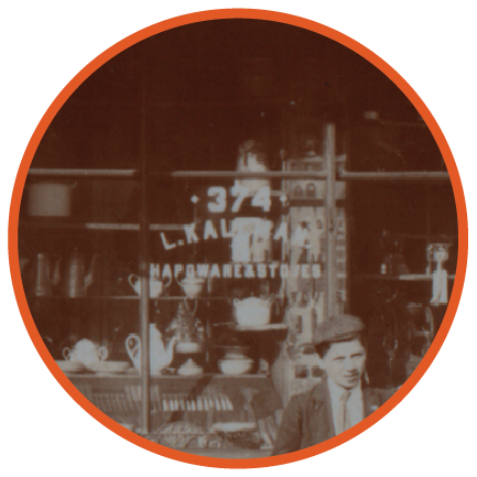 L. Kallman’s Hardware, Grand Street & Norfolk Street (1900)
 Map Warper, our website for crowdsourced map georectification
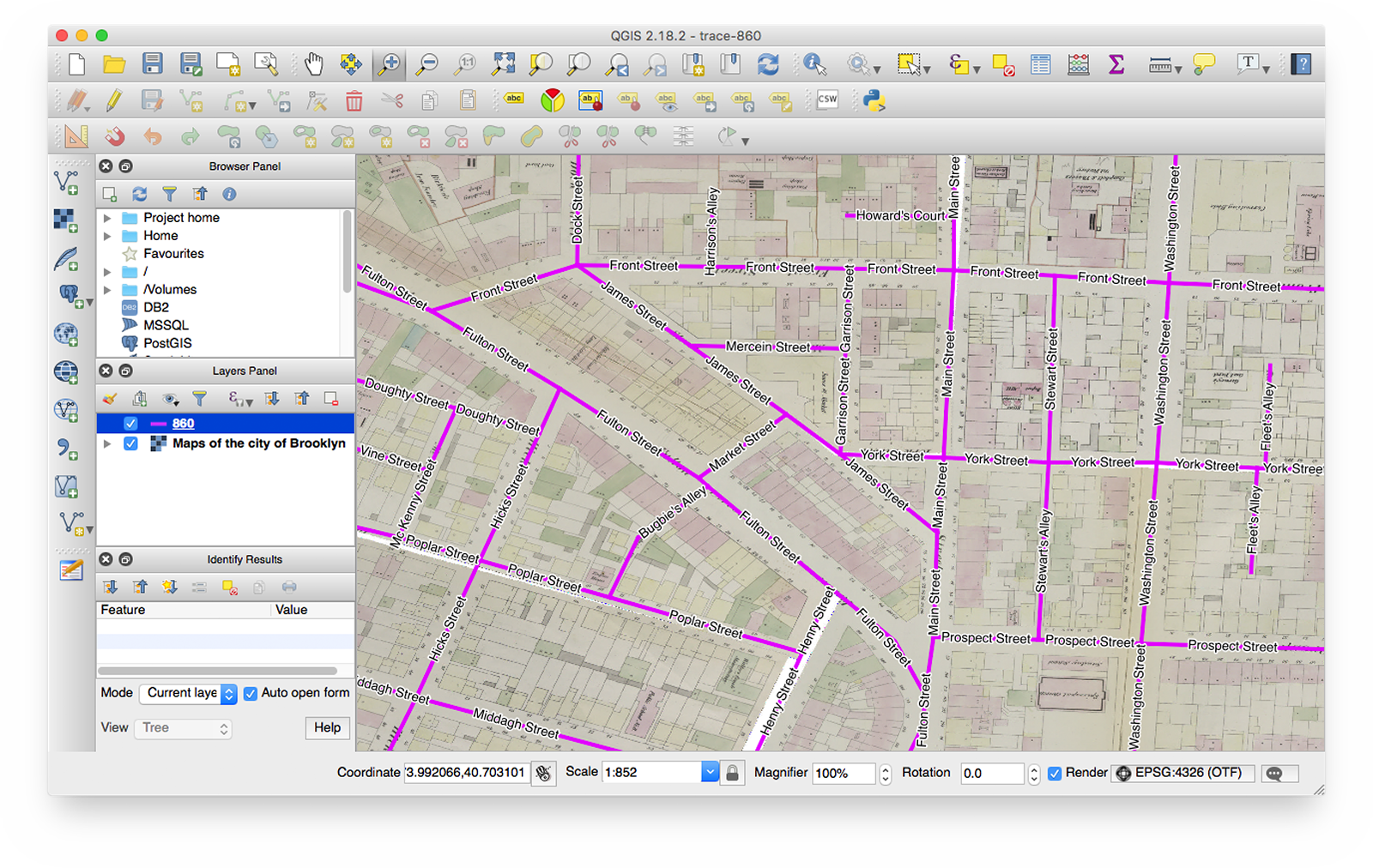 Tracing streets from historical atlases with QGIS
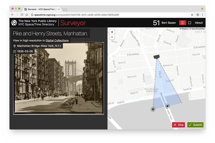 Surveyor: help the NYPL map its photo collections
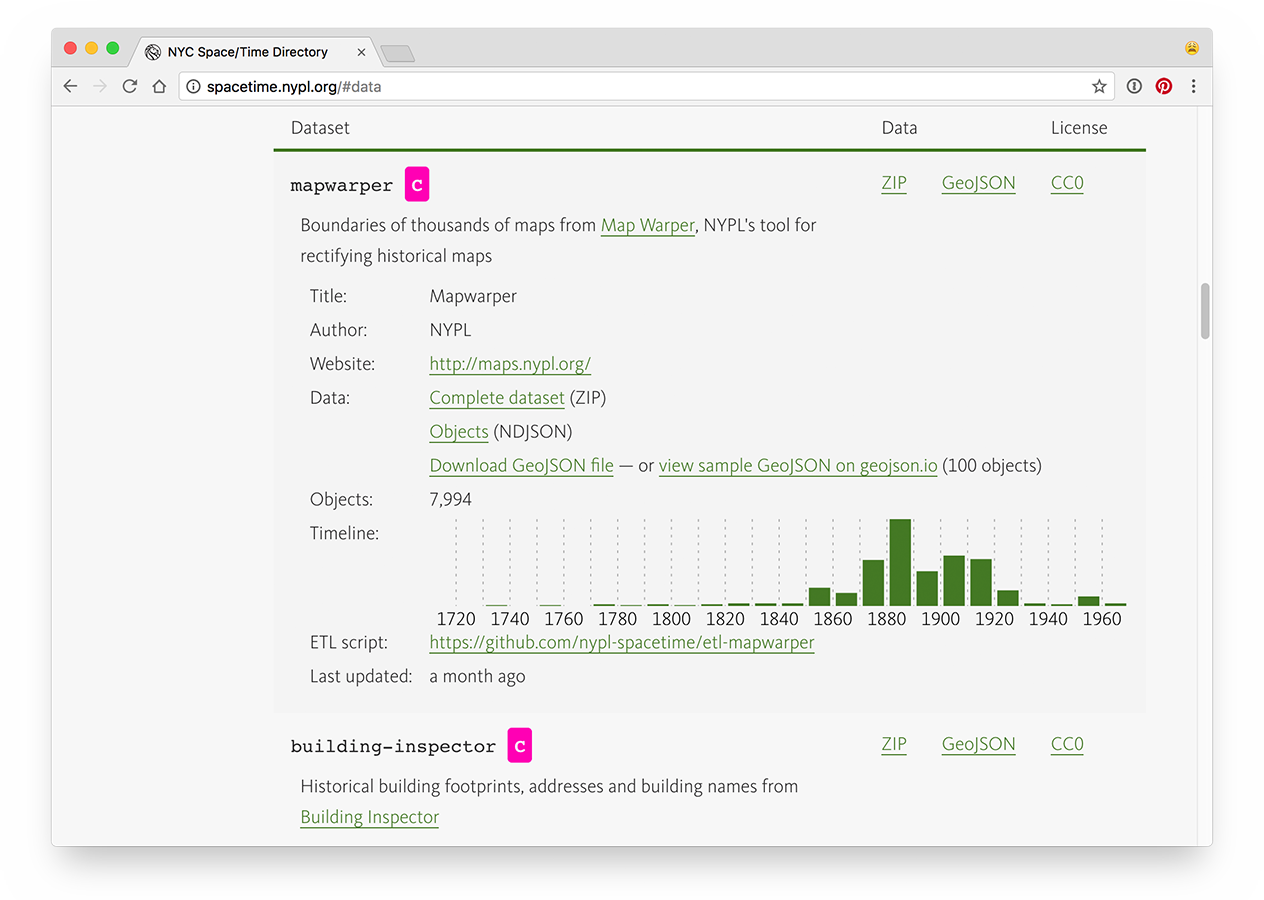 Open historical datasets on spacetime.nypl.org
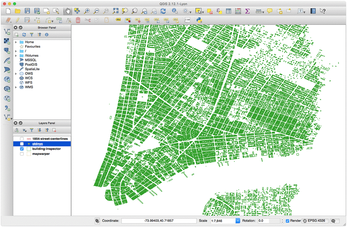 Datasets from the NYC Space/Time Directory visualized with QGIS
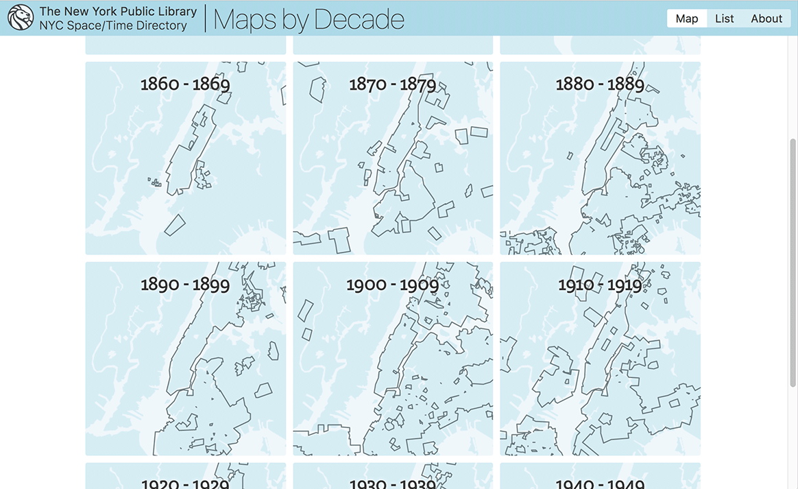 Maps by Decade, a new way to explore historical maps of New York City
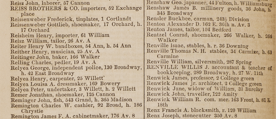
 We are using Tesseract to extract text data from city directories
 Detecting columns in OCR’d city directories
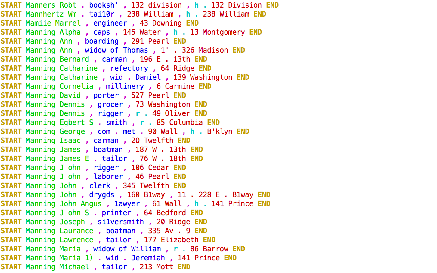 Conditional random fields (CRF) turn lines into data
| Fifth | ⟶ | Fifth Avenue |
| Rivington | ⟶ | Rivington Street |
| Av B | ⟶ | Avenue B |
| W. 17th | ⟶ | West 17th Street |
| B'way | ⟶ | Broadway |
| Merchants Ex | ⟶ | Merchants Exchange |
| Grace Ct. | ⟶ | Grace Court |
| Thirty-First | ⟶ | 31st Street |
| B'ry | ⟶ | Bowery |
 Graph of dataset dependencies in NYC Space/Time Directory
